Cellhphone GPS could have helped find child
A couple near riverside pleaded with sprint to track their car that was stolen with their baby in it. I am not sure what to think of this case. It seems like Sprint did the right thing. There is fine line between safety and privacy.
Saturday, December 31, 2005
Thursday, December 29, 2005
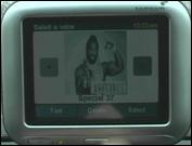
Company Offers Celebrity Voices for GPS Navigation Systems
This sounds kind of funny. I pity the fools that makes a wrong turn.
 Spot Geocaching with your phone or Blackberry
I am going to try this with my girlfriends blackberry. The company says it is subscritpion free.
Read More
A GPS extension for FireFox

I love firefox and there is now an extension for GPS that is linked to google maps.
Read More
Wednesday, December 28, 2005
The Chronic of Nardia on SLN last week mentioned Google maps are the Best. I thought this skit was funny and shows how main stream online maps are. If you are read for a laugh check it out. I am soon going to add Geocaching tutorials and hints.

FineDrive M700D
The fine drive has GPS and DMB Digital TV. Find more info on the model over at
Akihabara News
GPS Navigation Nightmare
With GPS all the rage these days one often forgets of it shortcomings. GPS systems are are as good as the data that is inputed into them . It great to always have a backup plan and for those Geocachers out there A Handhelp topo map and a compass can be your best ally.
Read More
With GPS all the rage these days one often forgets of it shortcomings. GPS systems are are as good as the data that is inputed into them . It great to always have a backup plan and for those Geocachers out there A Handhelp topo map and a compass can be your best ally.
Read More
Saturday, December 24, 2005
Mexens Technology LLC announced peer-to-peer GPS network Navizon,

Instead of satellite signals typically used by GPS devices, Navizon uses signals from nearby Wi-Fi and cellular towers. This technology seems like it could be useful in the city.
read more
B.C. mounties foil liquor theft with GPS
The Mounties have used a high-tech device to track a suspect in a major liquor theft.
About 200 cases of liquor, valued at $80,000, were stolen earlier this month from the Van-Kam Freightways trucking compound in the city earlier this month.
Read More
About 200 cases of liquor, valued at $80,000, were stolen earlier this month from the Van-Kam Freightways trucking compound in the city earlier this month.
Read More
Friday, December 23, 2005
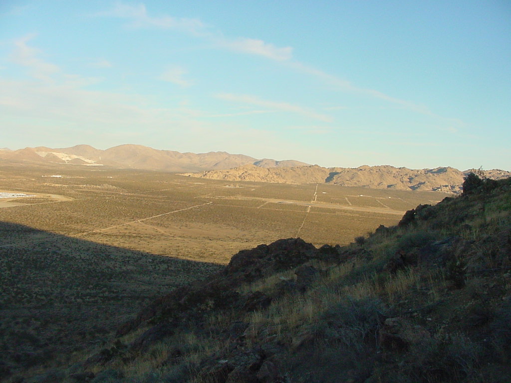
Geocaching A guide to the 10 essentials
I admit I am usually not the most prepared for Geocaching. My of the time I leave rushing out the door. The folks over at KeenPeople wrote a great article on the ten essentials.
Read More
Read More
Tom Tom GPS Threatens Tam Tam
Tom Tom GPS Treatens Tam Tam a mac navigation software, As a result Tam Tam is withdrawn from the market.
Read More
Tom Tom GPS Treatens Tam Tam a mac navigation software, As a result Tam Tam is withdrawn from the market.
Read More
Thursday, December 22, 2005

GPS finds its way under the tree
Never be lost again -- except trying to pick the right model
Read More
Never be lost again -- except trying to pick the right model
Read More
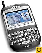
BlackBerry 7520 GPS
To me the Blackberry seems like the ultimate paperless caching machine. My girlfriend has one of these smart devices from work so I have had some time to play with one. Although we do not have a telenav or mapquest subscription, I was able to find our coordinates. You can have instant internet acess almost anywhere and it has a technology that makes up for spotty satellite coverage. Geocaching.com Came up in a flash out in the field.
Read More
Links for Geocaching
Are you new to Geo Caching head over to my del.icio.us bookmarks for site that will give you more information on the exciting sport of Geocaching
del.icio.us/zutnick
Are you new to Geo Caching head over to my del.icio.us bookmarks for site that will give you more information on the exciting sport of Geocaching
del.icio.us/zutnick
Cache IN Trash Out Geocaching
I lot of Geocachers practice Cache in Trash Out meaning that while they are caching they pick up garbage and bring it out with. This is a great way to clean up the environment but it is also a story to tell muggles if caught.
Wednesday, December 21, 2005
Google Earth has nations worried
When Google introduced Google Earth, free software that marries satellite and aerial images with mapping capabilities, the company emphasized its usefulness as a teaching and navigation tool, while advertising the pure entertainment value of high-resolution flyover images of the Eiffel Tower, Big Ben and the pyramids.
When Google introduced Google Earth, free software that marries satellite and aerial images with mapping capabilities, the company emphasized its usefulness as a teaching and navigation tool, while advertising the pure entertainment value of high-resolution flyover images of the Eiffel Tower, Big Ben and the pyramids.
GPS: Bold new directions BlackBerry 7520 GPS, Motorola's i870 multimedia phone
GPS: Bold new directions
As technology driving global positioning systems gets more powerful, the navigation devices get lighter, more accurate and are even turning up in cell phones.
Read More
As technology driving global positioning systems gets more powerful, the navigation devices get lighter, more accurate and are even turning up in cell phones.
Read More
Virtual Neighborhoods: Geocaching A high-tech game of hide and seek
Here is great artlicle about geocaching from the Naples Daily news, The lady in the story talks about using old maps to find boot in her neighborhod. The sport is only five years old and I have only four caches logged but I have found a hobby to get me off my but and use my brain. Looking for a family activity or if you just want to get out of the house take a close look at Geocaching.
Read More
Read More
GPS Games
Looking for other types of Geo Games to play. Head over to GPSgames.org to find games live Geo Golf and Geo Poker.
High-Tech Hunt Gets Mixed State Response
This is the first I have read about Law officers having mixed feelings about Geo caches. I have thought of creating acache myself and will certainly take their thought into consideration.
A GPS-Geocaching GLOSSARY FTF What does it Mean?
Here is a great Geocaching Glossary provided by the Boise Weekly
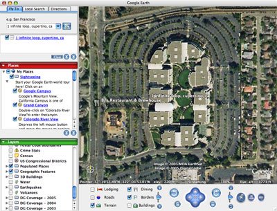
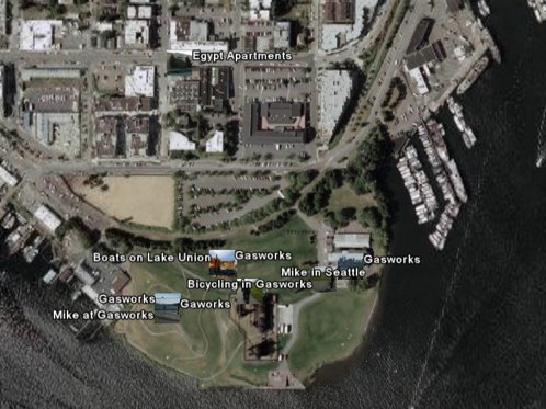
Using GPS Devices with Google Earth "Using GPS Devices with Google Earth"
If you have a GPS (Global Position System) device, you can connect it to your computer and import your waypoint and track data into Google Earth
If you have a GPS (Global Position System) device, you can connect it to your computer and import your waypoint and track data into Google Earth
Tuesday, December 20, 2005
New York Times: A Google Maps Guide to Commuting
The New York Times did their own mashup for Commuters
New York Transit Strike - Guide to Commuting - New York Times Interactive Graphic
The New York Times did their own mashup for Commuters
New York Transit Strike - Guide to Commuting - New York Times Interactive Graphic
UPS Package Tracking with Google Maps
Tried this to track some headphone I got for my girlfriend.READ More about how to get it working for you.
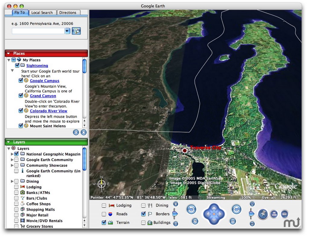
Terrabrowser for MacOS X
For all you Mac enthisists out there the is Terrabrowser for MacOS X. Below are just some of the great features in this program.
For all you Mac enthisists out there the is Terrabrowser for MacOS X. Below are just some of the great features in this program.
- Three map types:
- Color satellite maps (large urban areas only)
- Black and white satellite maps
- Topographical maps
- Map is draggable with the mouse or controllable via keyboard.
- Distance calculation option (hold down option and drag).
- Date of photograph and human readable location information provided (note that dates may be inaccurate since the date is only fetched for one of the map tiles, not all of them).
- Basic AppleScript support.
- Ability to save maps to a JPG file.
- Bookmarking ability for waypoints
War Zone Geocaching
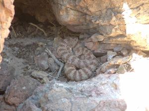
Click the Link below to go to cache that is located in Iraq. Suddenly hazards like this Rattle Snake at a cache I visited does not seem as hazardous.
read more
Monday, December 19, 2005
GPSVisualizer Supports Google Earth
Adam over at GPS borrowed a PC and now GPS Visualizer supports Google Earth. This is very exciting and I hope to try it soon.
Head over to GPS Visualizer and try it yourself.
Read More
Head over to GPS Visualizer and try it yourself.
Read More
GPS Could Speed Tsunami Warnings
GPS satellite receivers are already navigational must-haves for hikers and drivers. Now scientists are hatching plans to press them into service as tsunami predictors.
International organizations like the Pacific Tsunami Warning Center, or PTWC, in Hawaii currently depend on coastal seismic stations to record deep-sea earthquakes that could cause giant waves. But according to Jeff Freymueller, a geophysicist at the University of Alaska Fairbanks, data from GPS receivers could provide quicker, more accurate estimates of the magnitude of a tsunami-causing quake, buying time for evacuation. Freymueller presented his findings at this week's American Geophysical Union conference in San Francisco.
Raad More
Sunday, December 18, 2005
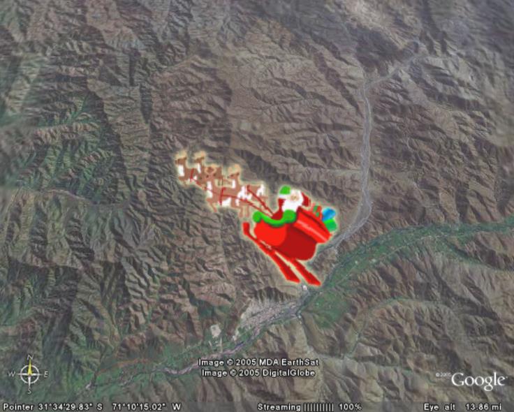
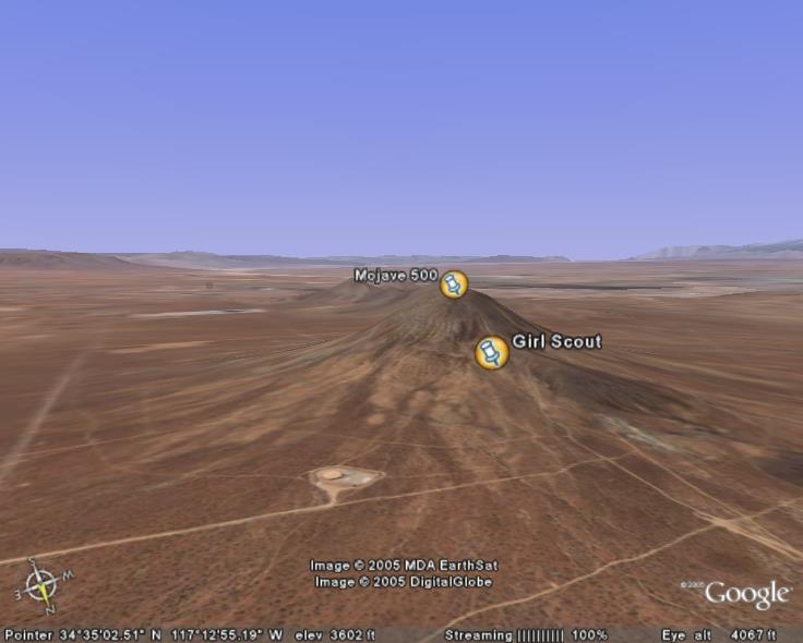
Geocaching meets Google Earth
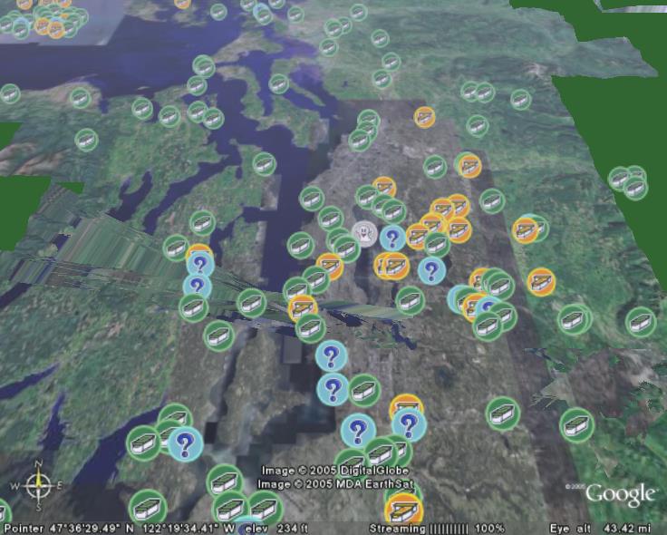
Using Google Earth, you can view geocaches all over the world! The link above is for the description page. To download it without an account, use this site:
http://geocaching.com/kml/buildnetworkkml.aspx
It should download and open the KML file in Google Earth. After zooming in to within 500 miles, the geocaches will start popping up.
read more | digg story
Saturday, December 17, 2005
Wayfaring Maps
With Wayfaring.com you can explore maps created by others, or create your own personalized map. Share them with friends or the whole world.
Read More
Read More
Google Transit a no-go with Safari
Google's new Transit trip-planning service doesn't work with Safari. If you try to access Transit in Safari, you get this "help" message:
Unfortunately, Google Transit doesn't currently support the Safari web browser—but we're working on it! In the meantime, we recommend Firefox for viewing Google Transit on the Mac.
Unfortunately, Google Transit doesn't currently support the Safari web browser—but we're working on it! In the meantime, we recommend Firefox for viewing Google Transit on the Mac.
Friday, December 16, 2005
What's My GPS? A Tutorial on How to Add GPS Data to Your Website/Blog
You probably know what your zip code or area code is (at least I hope so) but what about the GPS of your house? Global Positioning System (GPS)* can be useful for everything from calling 911 on your cell phone to using a navigation system in your car. But what can you do with the GPS information of a street address? Well, you can go GeoCaching and search for hidden treasure in your neighborhood. However, a more practical use would be to add some HTML metadata code to your website/blog and see a list of your physical neighbors from cyberspace. Sound like fun?
Read more
Read more
Thursday, December 15, 2005
Japanese To Digg 4.5 Miles Into Earth Surface
An ambitious Japanese-led project to dig deeper into the Earth's surface than ever before will be a breakthrough in detecting earthquakes including Tokyo's dreaded "Big One," officials said Thursday...
read more | digg story
read more | digg story
Download Google Earth For Mac OS X!
Download Google Earth for MacOS X
Ok, so you know there is a beta of Google Earth floating on the net.
Wednesday, December 14, 2005
GPS: Supervision or high-tech snoopervision
Is she driving? How fast? Is he really at the library, or at an unchaperoned party across town?
read more | digg story
read more | digg story
Tuesday, December 13, 2005
HOW TO GPS Tag Photos: Flickr, Mappr, Google Earth....
I am going to try this soon and will report back with results
Here's the simple, non-techy way of tagging photos with the location of where you took them on planet Earth. There are lots of ways to do this, and I'll write about those later- but this is fun thing to do over the holiday weekend. As an added bonus, I'll show you how to see your photos on a cool Mapping application called Mappr, as well as Google Earth...
Read More

howto: geocaching with google and terraserver
If you’re into geocaching, terraserver and google maps can be your greatest allies. well, maybe second greatest, right after your trusty gps receiver. with terraserver, you can pull up hires satellite photos and topo maps of just about everywhere in the continental us. with google maps, you can easily pull up a road map and driving directions.however, one thing i noticed when google maps launched was that it’s interface is conspicuously lacking a lat/lon entry field. it turns out there are a couple of query parameters that you can use to pull up coordinate based maps. with this info, you can make a simple form to pull up both map results for a given latitude/longitude combination, which should hopefully be a handy tool for your next gps treasure hunt. Read more
Monday, December 12, 2005
Garmin Adds XM to New Portable GPS Units
READ MORE: 2730, 7200, 7500, Garmin, Portable Media, StreetPilot
Garmin has finally upgraded its portable StreetPilot GPS line. I love XM and all GPS Gadgets. This includes all kinds of extra traffic management notifications like where accidents are, road construction, and weather-related traffic delays before they are encountered. And even better, you’ll get alternate routes to where you’re going. This info will be supplied either by XM NavTraffic—which is the first satellite-based data traffic in the US and works very well—or Clear Channel’s RDS-TMC Total Traffic Network. The new units also include optional entertainment options, like an internal MP3 player, XM radio subscription, or eBooks from audible.com. The 7500($1899) and the 7200($1499) both have 7-inch touchscreens and a SD card slot so you can just take your music with you. The 7500 also has what is called Dead Reckoning, which will allow you to keep all your navigation information even if you lose your GPS signal. The StreetPilot 2730 ($1199), on the other hand, has only a 5-inch screen and doesn’t have an SD slot, which means you have to plug it into your computer to download any music you may want to take with you. All three will come out in December.
Sunday, December 11, 2005
Friday, December 09, 2005
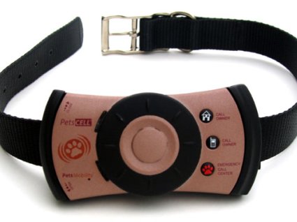
PetCell GPS tracker phone for dogs
Aw yeah, you know Fido ain’t be going nowhere these days if he isn’t sporting a cellie, and now he can impress the ladies with some cameraphone action. PetsMobility threw down the PetsCell last year, and now they’re losing an “s” and going for broke with their latest version, PetCel.
Read More
Waymarking.....Where is it at?
Head over and check out the new offshoot of Geocaching called Waymarking.
Looking for a Wi-fi hotspot, a plane crash site, or perhaps an odd-shaped building near you? Browse hundreds of interesting categories for exact coordinates or post one of your own. The largest category so far... McDonald's Restaurants!
read more | digg story
Thursday, December 08, 2005
Live Local powered by Virtual Earth is running
Check out Microsofts newest Virtual Earth....the detail is amazing and almost scary.
read more | digg story
read more | digg story
Wednesday, December 07, 2005
First ever map of North America
This map predates anything Columbus had. It is said to have been made nearly 60 years before Columbus steped foot in the west indies.
read more | digg story
read more | digg story
Swiss company releases "indoor" GPS system
U-blox a Swiss provider of GPS receivers announced an apparently very sensitive GPS device. The LEA-4H, the company claims, is able to receive "the weakest signals" - even in places with obstructed views. In fact, the device is sensitive enough to calculate geographical positions within in buildings.
Acquisition and reacquisition sensitivity of the LEA-4H is rated at -148 dBm, cold start sensitivity at -142 dBm and tracking sensitivity at -158 dBm, U-blox said. The device is also Assisted-GPS capable.
ReadMore
Learn about Geocaching at Wiki
GeoCaching is a neat scavenger/Easter egg/treasure hunt using GPS Units. GeoCaches are starting to show up everywhere from cities to rural areas. Use the Internet to find waypoints and clues about where the cache is hidden. It is a lot like letterboxing.
read more | digg story
read more | digg story
Tuesday, December 06, 2005
How to Tie Useful Knots
Only know how to tie a knot in a shoelace? Check out these useful knots and follow the simple instructions. Now all I need is a decent rafter and a chair.
read more | digg story
read more | digg story
Subscribe to:
Posts (Atom)